Sometimes on a cold winter afternoon, it's fun to plan a cruise or, as we have done here, set up a route that we can use on our Netbook computer when we're underway.
The navigation software that we've been using for the past couple of years is made by Polar Navy and it comes in two pieces: PolarView (the chart application shown here) and PolarCom, which is a simulated set of navigation instruments that can be set up to show Heading, Speed Over Ground, Distance Covered, etc. In fact, you can set PolarCom up to display virtually any information you have available in NMEA 0183 (or NMEA 2000, I believe) format.

Here's the PolarCom application running over PolarView. Here at home, we don't have any GPS input so it's showing the default, Current Position, Speed over Ground and Course, all of which are zero. The default instrument size is somewhat big, but you can make it smaller and move it around, out of the way, on the chart by just dragging it.
PolarView costs just $39.95 and PolarCom comes with it for free. That purchase gives you a license to download any of the ENC or Raster charts whenever you want to. You also get three seats, so that you can load it onto a home PC and perhaps a laptop, as we have done.
If you create a route for an upcoming cruise at home, PolarView makes it easy to export that data (via an Excel .csv file) to a flash drive and then later, import the data onto your boat computer.
PolarView is also integrated with Active Captain data so you can click on an Active Captain point-of-interest and read what other Active Captain members have said about it.
You can name the routes and the individual waypoints and waypoints can be shared between routes. Once a route leg is established, PolarView shows you its distance and relative bearing to the next waypoint, which is really useful.
We use our little Acer Netbook and a small puck-type GPS receiver while underway. Our boat's position is shown on the chart at any scale we choose, making it easy to follow a particular planned route without leaving a snake-wake in the ocean behind us.
Sure, all of this can be done with multi-function navigation displays but they cost a lot more than we're willing to invest. We use a Standard Horizon chartplotter that gets its GPS info from an external antenna and sends waypoint data to our old reliable Furuno radar, but the PolarView chart display on our computer is so much easier to read and from what we can see, the GPS position is also more accurate.
It is also really tedious to plan a route on the Standard Horizon plotter with its little joystick. Now we plan the route using PolarView and then just key in the coordinates of the waypoints in on the chartplotter.
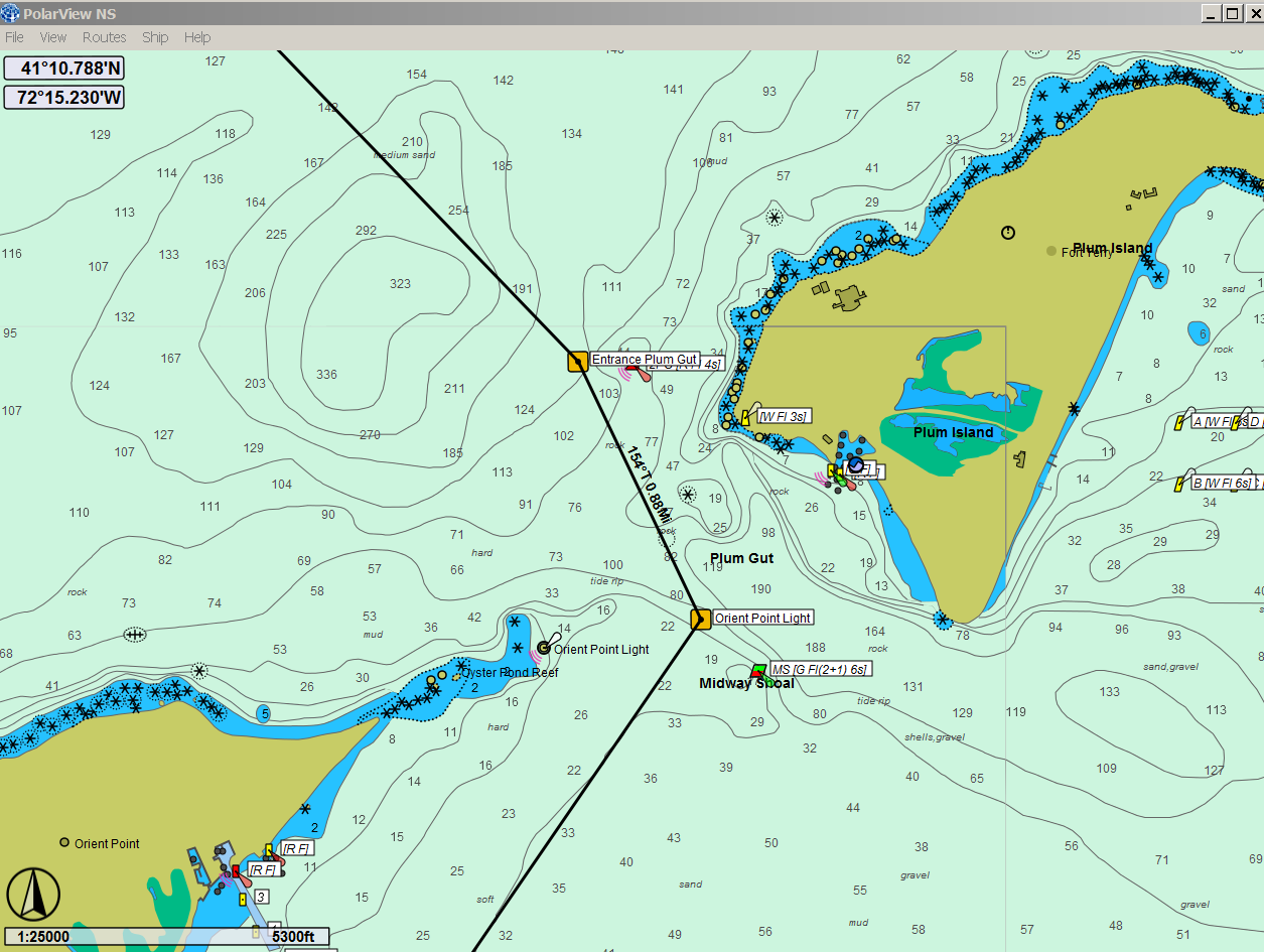
The first screen-grab photo above shows Plum Gut, one of of favorite 0.88 miles of water. We've probably been through there 200 times and we don't really need those waypoints but, there were those times when the fog was so heavy that...
But we all have our fog stories so we won't bore you with ours.
No comments:
Post a Comment